

おおいた防災アプリ
| Developer: | 大分県 |
|---|---|
| OS: | Android |

About おおいた防災アプリ
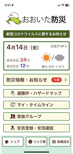
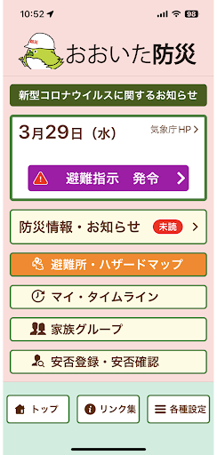
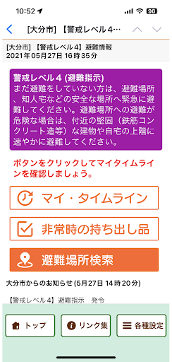
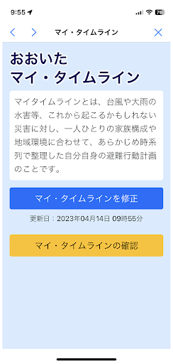
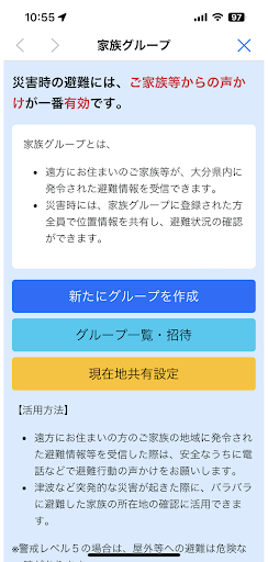
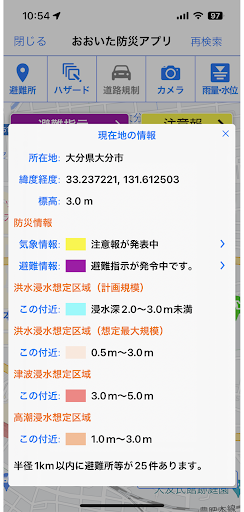
“Oita disaster prevention app” is the official app of Oita prefecture.Designated evacuation shelters and designated emergency evacuation shelters around your current location and details are displayed, and route guidance to that point, AR camera function, and evacuation compass function support evacuation behavior in the event of a disaster.In addition, hazard maps such as sediment-related disaster warning areas, flood inundation areas, and tsunami inundation areas are also displayed, so you can check the danger of your current location.In addition, we will notify you of various disaster prevention information such as evacuation information and weather warnings by push notification.The “Oita disaster prevention app” can be used not only in Oita prefecture but all over the country, and the map display can be used even when offline.[Main functions]・ Automatic search for designated evacuation shelters and designated emergency evacuation shelters around your current location・ Route guidance to designated evacuation centers, etc.・ Hazard map display of sediment-related disaster warning areas, inundation areas, etc.・ Display of road regulation information and camera information・ Display of disaster prevention information and danger information at your current location・ AR camera function, evacuation compass function・ Offline function・ Push notification of disaster prevention information, list display・ Safety registration, safety confirmation
Screenshots


About Developer
Developer Name: 大分県
Website: https://www.pref.oita.jp/
Email: [email protected]
Address: OITA PREFECTURE [email protected] 3-1-1, OTEMACHI
OITA, 大分県 870-0022
Japan +81 80-2221-3327
More Information
Privacy Policy: View